Skip to main content
The University
of
Kansas
MENU
link to menu page
THE UNIVERSITY
of
KANSAS
Kansas Applied Remote Sensing
The GreenReport
myKU
Email
Canvas
Enroll & Pay
Jayhawk GPS
Close
Search this unit
Start search
Submit Search
Main navigation
Home
Introduction
Uses for the GreenReport
Info for
Prospective Students
Current Students
Alumni
Degree Programs
THE UNIVERSITY
of
KANSAS
University of Kansas logo
Kansas Applied Remote Sensing
The GreenReport
Menu
link to menu page
Search this unit
Start search
Submit Search
Home
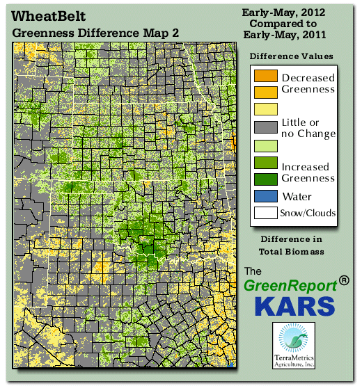
Wheat Belt Difference Map 2